• Day 01 Drive to Machha Khola (869m | 2850ft, 160 km, 9–10 hrs)

    The Tsum Valley & Manaslu Circuit journey starts early today from Kathmandu. Your guide will meet you at the hotel. From here, the team will take either a local bus or a private jeep. The jeep is more comfortable.

    As the drive begins, you slowly leave behind the noise of the city. The road moves through green hills and local towns. After a while, you reach Naubise and then head toward Dhading Besi. Along the way, you will see the Trishuli River flowing beside the road.

    You stop at Jyamire for lunch. This place gives you your first experience of a small highway town in rural Nepal. After lunch, the road becomes more rugged. As you travel deeper into the hills, the air becomes fresher.

    You pass Arughat and Soti Khola in the late afternoon. These are busy villages that connect the region. Slowly, you arrive at Machha Khola. The village is quiet and small. It has about thirty to forty houses. Most of the people are farmers and shopkeepers.

    Tonight, you rest at a local lodge. The rooms are basic but clean. The sound of the river nearby makes the place feel peaceful. This is the gateway to the Manaslu region. The village is simple. But the calm nature and warm people make you feel welcome.

    Tomorrow, your trek will begin. But for now, take time to relax and enjoy the quiet night in Machha Khola.

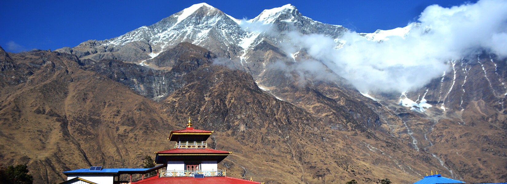
    • Place: Machha Khola
    • Altitude: 869m
  • Day 02 Trek to Jagat (1340m | 4395ft, 16km, 6–7hrs)

    Today is the first day of trekking. After a warm breakfast, we leave the quiet village of Machha Khola. The trail goes beside the Budhi Gandaki River. The sound of the flowing river gives us a calm feeling. Small paths lead us through fields and forests. The morning walk is easy and pleasant.

    Soon we reach Khorlabesi. This is a small village with traditional houses. From here the trail moves toward Tatopani. Tatopani means hot water. There is a natural hot spring here. Many trekkers stop for a short break.

    After a short uphill walk, we reach Doban. We stop here for lunch. The air is fresh and the hills look beautiful. Then we continue walking slowly. On the way we cross many small bridges.

    We also pass through Yaru Bagar. Here we walk across a special bridge called a Cantilever Bridge. It is strong and safe. The bridge was made with new technology after the earthquake. From here, we climb up slowly and reach a peaceful village named Jagat.

    Jagat is a small village with stone houses and narrow paths. Gurung and Tamang people live here. Their culture and lifestyle are very simple. This village is also a checkpoint for the Manaslu Conservation Area. We stop here for the night. The quiet air and warm food help us relax after a long day.

    • Place: Jagat
    • Altitude: 1,340m
  • Day 03 Trek to Lokpa (2240m | 7347ft, 13 km, 6–7 hrs)

    We start the second day of our trek early with a warm breakfast. The fresh mountain air makes the morning feel peaceful. After packing our bags we leave the Jagat village behind. The trail moves ahead slowly through stone steps and peaceful forest paths.

    Soon we pass by Salleri village. From here we get a clear view of Mount Sringi. The mountain stands tall in the background. After Salleri the path goes slightly down to reach Sirdibas. This is a small Buddhist village with prayer flags and old stone houses.

    Now we climb a little and reach Philim. This is one of the big villages in this region. We also stop here to show our trekking permits. This is the entry point to the Manaslu Conservation Area and the Tsum Valley. After that we take a break and enjoy our lunch at Chisapani.

    After lunch we continue walking. Then we reach Ekle Bhatti. From here the trail slowly climbs up again. We walk through gorges and pass rocky cliffs. This part feels a little harder but the cool breeze helps us keep going.

    Soon we arrive at Lokpa. It is a small, quiet village with only a few houses. This is the first village on the Tsum Valley route. People here follow Tibetan Buddhism. From Lokpa, we can see beautiful views of Himalchuli and Boudha Himal. The village feels calm and peaceful. The air is fresh and the mountains look close. After a long day of walking, we rest at the tea house. The sky turns golden as the sun sets behind the hills.

    Tonight we sleep in Lokpa and prepare for the next day’s journey.

    • Meals: Breakfast+Lunch+Dinner
    • Accommodation: Tea House
    • Place: Lokpa
    • Altitude: 2240m
  • Day 04 Trek from Lokpa to Chumling (2386m | 7826ft | 7km | 4–5hrs)

    We begin our trek from Lokpa after a warm breakfast. Today the trail takes us deeper into the Tsum Valley. At first we walk through a landslide area. It is one of the biggest on this route. The trail is rocky and we stay alert for falling stones.

    After we cross the landslide section the path becomes quiet and peaceful. We walk through forests filled with pine fig and rhododendron trees. The sound of birds and the rustling of leaves makes the walk calmer.

    We continue to hike up and down. We pass through narrow ridges and thick trees. Then we reach a small suspension bridge. This bridge leads us towards the Chumling village. After we cross the bridge the trail drops steeply.

    Soon we see a few stone houses ahead. That is Chumling. This is the first village inside the Tsum Valley. It takes around four to five hours to reach here from Lokpa. Since there are no lunch places on the way we eat after we arrive in Chumling.

    Chumling is a small and beautiful village. There are only a few houses made from stone and mud. Most people here follow Buddhism. You can see prayer flags and mani walls around the houses. These places show the deep spiritual life of the people here.

    The Chumling village gives us a great view of Ganesh Himal and Shringi Himal. In the evening we can explore the area or rest in the tea house. Tonight we’ll stay here in Chumling.

    • Meals: Breakfast+Lunch+Dinner
    • Accommodation: Tea House
    • Place: Chumling
    • Altitude: 2386m
  • Day 05 Trek to Chhokangparo (3031m | 9941ft | 8km | 5–6hrs)

    After breakfast we begin our walk for the day. We cross a suspension bridge early in the morning. Then we continue on a short walk towards Tanju village. From here you can get an amazing view of Ganesh Himal and Baudha Peak. The trail becomes easy as we walk further into the Upper Tsum Valley. We pass through several villages like Rainjam and Gho.

    Along the way we see beautiful landscapes and Tibetan houses. The walk takes us over ridges and flat meadows. We have to be careful as we pass through some landslide-prone areas.

    After a few more hours of walking, we finally reach Chhokangparo. This village is the largest in Tsum Valley. It has two parts: Chokhang and Paro. Chhokangparo is surrounded by fields and old monasteries. Chhokangparo is a quiet and welcoming village rich in Tibetan culture.

    The people of Chhokangparo follow Buddhism and live a peaceful life. They raise goats and yaks. Some make chhurpi or collect yarshagumba, which is a rare fungus used in medicine. It offers fantastic views of Ganesh Himal.

    Today we have lunch in the village and rest for the night. The simple but comfortable teahouses will give us the rest we need for the next day's adventure.

    • Meals: Breakfast+Lunch+Dinner
    • Accommodation: Tea House
    • Place: Chhokangparo
    • Altitude: 3031m
  • Day 06 Trek to Nile (3361m | 11026ft | 9.5km | 5–6hrs)

    After having a warm breakfast we leave Chhokangparo and walk slowly towards the north. The trail is not steep but it keeps going up. The trail is open and wide. It feels calm and peaceful. We pass through small villages like Lamagaon and Burji. These villages are quiet and beautiful with fields and stone houses that make the walk feel like a step into the past.

    After a while we visit Milarepa’s Cave. This is a sacred place where a great saint meditated long ago. People believe his spirit still blesses this land. We stop here for a short rest and offer prayers. We continue walking and reach a small place called Chi Phu. The view of Ganesh Himal keeps getting clearer.

    At some time, we’ll reach Nile. This is the last village before the border of Tibet. It has around 30 to 40 houses. People here live a simple life. They grow crops and take care of animals. They follow Tibetan Buddhism with full heart. The village feels quiet but full of life.

    We stay at a teahouse for the night. Before dinner we may visit the Rachen Gompa nearby. We can also talk to monks to know more about the religion they follow there. Nile is cold and silent at night but the stars above and the warmth of local life make it feel like home in the mountains.

    • Meals: Breakfast+Lunch+Dinner
    • Accommodation: Tea House
    • Place: Nile
    • Altitude: 3361m
  • Day 07 Acclimatization Day at Nile – Hike to Mu Gompa (3700m | 12136ft | 4.3 km | 3–4 hrs)

    We wake up early and enjoy a warm breakfast today in the Nile village. Today is an acclimatization day to help our body adjust to the high altitude. We leave our heavy bags at the tea house. Then we begin a slow and steady walk to Mu Gompa. The trail is newly built and it goes uphill. As we go higher the air feels cooler and fresher. We walk through quiet land with wide open views and you’ll see the mountains closely.

    After around three hours we will reach Mu Gompa. This is the biggest monastery in the Tsum Valley. It stands proudly at 3700 meters and is the highest point in the valley. It was built in the 19th century. It has old Buddhist books, paintings and statues along with walls covered with colorful murals of Guru Padmasambhava and Tara.

    Many monks live and study here. If we are lucky we may meet some of them. They live a simple life and follow the old ways of Tibetan Buddhism. From the monastery we see the Tibetan Plateau and snow-covered mountains. The view is wide and clear. The valley looks like a big bowl with hills all around.

    After enjoying your time, we walk downhill and reach the tea house where we take a rest. A hot meal and warm bed feel good after a long day.

    • Meals: Breakfast+Lunch+Dinner
    • Accommodation: Tea House
    • Place: Mu Gompa
    • Altitude: 3700m
  • Day 08 Trek to Chumling (2470m | 8101ft | 17.5 km | 6–7 hrs)

    We wake up early in the Nile and have a warm breakfast to get ready for the long walk ahead. Today we move down to a lower place. The air feels thicker and warmer as we descend. The trail feels easier than before. We follow the same path we took earlier giving us more time to look around and enjoy the view.

    We will reach Phurba after some time. The houses here are simple and quiet. Then we walk along the side of Siyar Khola. The river flows calmly beside us. The sound of water feels peaceful.

    We continue walking and reach Rachen Gompa. It stands proudly in the middle of Greenland. If the sky is clear, we can see the Kipu Himal behind it. We stop for a short rest. After that, we walk again, passing through villages like Chhokang Paro and Domje.

    After some hours, we stop for lunch at a place called Gho. A simple hot meal gives us new energy. Then we walk the last stretch to Chumling. By late afternoon, we will reach Chumling. This is where we spend the night. The tea house feels cozy and calm.

    Today we walked a long way. We end the day with warm food and much-needed rest.

    • Meals: Breakfast+Lunch+Dinner
    • Accommodation: Tea House
    • Place: Chumling
    • Altitude: 2470m
  • Day 09 Trek to Deng (1860m | 6100ft | 14.5 km | 5–6 hrs)

    The morning in Chumling feels fresh and cool. After breakfast we begin our walk. Today we leave behind the Tsum Valley trail. First we go downhill to reach Nyak Phedi. The slope feels steep at times. So, we move slowly.

    The trail is quiet with tall trees and distant hills. You will hear birds singing softly from the forest. After some time we reach a suspension bridge. It hangs above the Budhi Gandaki River. The river rushes far below us. On the other side the trail climbs again. We go uphill step by step. As we walk we pass small fields and stone houses. Local people wave as we pass by.

    Soon the view opens. We see Sringi Himal in the distance. Its white peaks shine under the sun. The trail moves through bamboo and rhododendron forest. After a few more hours we reach Deng. It is a quiet Gurung village. The people here live simple and happy lives.

    We check into a tea house. It feels nice to sit down and rest. The day ends with a warm meal and peaceful sleep.

    • Meals: Breakfast+Lunch+Dinner
    • Accommodation: Tea House
    • Place: Deng
    • Altitude: 1860m
  • Day 10 Trek to Namrung (2630m | 7048ft | 15 km | 6–7 hrs)

    The day starts early in Deng. After a warm breakfast, we get ready for the walk. The morning air feels cool and fresh. We begin our trek through small fields and forest trails. After some time, we climb gently to reach Rana village. From here we move toward Bhimphedi. Along the way we see small Mani walls and prayer wheels. The trail feels quiet and calm.

    As we walk we cross the Budhi Gandaki River many times. Then we pass through a dense forest. There are tall rhododendron trees and bamboo plants on both sides. Soon we reach Ghap. This small place sits near the river. It is a good spot to take a short rest. The views of Sringi Himal from here are very clear.

    After Ghap the trail climbs again. This part is steep and takes time but we go slow and steady. As we go higher the view opens more. We can see Ganesh Himal and parts of Manaslu. Finally we reach Namrung. This village feels neat and beautiful with houses made of wood and stone. The local people here are Nubri. They follow Tibetan Buddhism. They greet us with warm smiles.

    Namrung has some of the best tea houses on the trail. The rooms feel warm and cozy. After a long walk it feels good to rest here. We eat our dinner and relax. The night is quiet and peaceful. We sleep early to prepare for the next day.

    • Meals: Breakfast+Lunch+Dinner
    • Accommodation: Tea House
    • Place: Namrung
    • Altitude: 2630m
  • Day 11 Trek to Samagaon (3530m | 5-6 hrs)

    After a warm breakfast, you leave the peaceful village of Lho. You pass farms where locals grow potatoes and take care of animals. As you walk ahead, the path becomes wide and open. You slowly reach a small village named Shyala. It sits in a beautiful flat area surrounded by tall mountains. You see Mount Manaslu standing high in the sky along with Himal Chuli and Naike Peak.

    Soon the forest becomes thinner and the air feels fresh. Yaks graze on the green fields beside the trail. You pass long stone walls with prayers written on them. You also see colorful prayer flags dancing in the wind. The trail remains easy and calm. You feel the beauty of the mountains in every step.

    After a few more hours of walking, you see rows of stone houses from a distance. This is Samagaon. It sits under the shadow of Mount Manaslu. The view is simply magical. Samagaon is a big village with kind people and deep traditions. Most people here follow Tibetan Buddhism. The village also has a monastery and a few teahouses to stay in. There is even a small health post and a place for emergency helicopters.

    The village is quiet and full of life at the same time. In the evening, you can visit the monastery or just walk around the village. If you have energy left, you may hike to Pungyen Gompa for a close view of the Manaslu Glacier. Otherwise, you can rest and enjoy the peaceful surroundings.

    • Meals: Breakfast+Lunch+Dinner
    • Accommodation: Tea House
    • Place: Samagaon
    • Altitude: 3530m
  • Day 12 Trek to Manaslu Base Camp and back to Samagaon

    Today is a special day. You spend one more day in Samagaon to help your body adjust to the height. After breakfast you leave your bag at the lodge. Then you begin your walk. You feel calm as you move through the open land above the village. The mountain views get better with every step. You walk past rocky paths and small streams. You also see yaks and dzopkyos grazing on the hills.

    Soon you reach Birendra Tal. This is a glacial lake near the Manaslu Glacier. The water is cold and still. You stop here for a while to enjoy the view with silence around the lake as it feels peaceful. The trail gets harder from here onwards.

    After some time you reach Manaslu Base Camp. It is at a high altitude around 4800 meters above the sea. From here the view is amazing. You see the tall peaks all around you with Mount Manaslu standing just above. You will also see Himalchuli and Ganesh Himal.

    This place feels far away from the rest of the world. Later you walk back down the same way. The downhill trail is easier. On the way back you may stop at the old Kargyu Chholing Monastery. This place is 500 years old with old carvings and prayer flags.

    By late afternoon you arrive back at Samagaon. In the evening you can relax at your lodge. Or walk around the village. Tomorrow you continue your journey. But today you slow down. A day to feel the power of the mountains.

    • Meals: Breakfast+Lunch+Dinner
    • Accommodation: Lodge
    • Place: Manaslu Base Camp
    • Altitude: 4800m
  • Day 13 Trek to Samdo (3860m | 12660ft | 3hrs)

    We leave Samagaon after a warm breakfast. The trail is peaceful that moves slowly along the Budhi Gandaki River. At first, we walk past farmlands and yak pastures. Then the path enters a forest filled with juniper and birch trees. As we go higher, the valley starts to open wider.

    We pass by many mani walls that bring a spiritual touch. After that, we reach the white Kani gate that marks the way to Samdo. We continue on a steady path that leads us to the village. After walking for around three hours, we arrive in Samdo. It is a small village with around 30 houses. This is the last settlement before the Tibetan border. The people here belong to the Bhotia community.

    Samdo sits close to the Tibetan border. It has a dry and rocky landscape. But the views here are big and beautiful. From here we can see Mount Manaslu and other peaks like Simnang Himal and Ngadi Chuli. The village also has a small Tibetan refugee area. They live in strong stone houses made to face the cold.

    After reaching Samdo, we take a break and enjoy lunch. The air is thinner here so resting helps our bodies adjust. This stop is also important for acclimatization. We spend the night in a teahouse in Samdo.

    • Meals: Breakfast+Lunch+Dinner
    • Accommodation: Lodge
    • Place: Samdo
    • Altitude: 3860m
  • Day 14 Acclimatization Hike to Rui La (Tibetan Border) (4998m | 16393ft | 8hrs)

    Today is our acclimatization day. We stay one more night in Samdo. In the morning we begin a slow hike to Rui La which stands near the border between Nepal and Tibet. The walk is long but rewarding.

    We follow a quiet trail that climbs slowly up. The pass sits at 4,998 meters above sea level. From here we can see far and wide. The views are very beautiful. We can see Mount Manaslu standing tall. Larkya Peak and Hiunchuli also look very close. The Samdo Glacier is right below with a large wall of ice sitting above the glacier. We also see Kang Guru and other snowy peaks around us.

    Rui La is more than just a viewpoint. In the past it was a trade route. People from Nepal and Tibet came here to exchange goods. They traded salt wool and livestock. Today it is quiet but still full of meaning. It connects the culture of the two lands.

    We take a break at the top and enjoy the fresh air. We breathe slowly and stay calm. This hike helps our body adjust to the high altitude. That will help us tomorrow during the big climb to Larkya La. After spending some time here we begin to walk back.

    Slowly we return to Samdo in the afternoon. The rest of the day is for rest and warmth. We spend the night again in a teahouse. The day was long but also special. It was a day full of mountain views and history.

    • Meals: Breakfast+Lunch+Dinner
    • Accommodation: Lodge
    • Place: Rui La
    • Altitude: 4998m
  • Day 15 Trek to Dharamshala (4460m | 14628ft | 6 km | 4–5 hrs)

    We leave Samdo after breakfast. The walk is not very long. At first the trail moves through wide yak pastures. The land is open and quiet and you can see big mountains in the distance. Manaslu peak and Larkya peak stand close from here.

    As we go higher the trees start to disappear. The trail becomes dry and rocky. We cross small streams on wooden bridges. Along the way we see prayer flags. We also pass chortens and stone walls with prayers. They also show the deep faith of the people in the mountains.

    If we are lucky we may see trade happening at Larke Bazaar. In the past people from Nepal and Tibet traded goods here. After this point the trail climbs slowly to Dharamshala. This place is also called Larkya Phedi. It sits at 4460 meters. It is the last stop before the Larkya La Pass.

    There is only one tea house here. It is simple but warm. We eat and rest here. The views around us are beautiful and we can see the Larkya Glacier and many snowy peaks.

    Tonight we sleep early as tomorrow will be the hardest day of the trek. So this rest is very important. We prepare ourselves for the pass.

    • Meals: Breakfast+Lunch+Dinner
    • Accommodation: Tea House
    • Place: Dharamshala
    • Altitude: 4460m
  • Day 16 Trek to Larke La Pass (5106m | 16751ft) and hike to Bhimtang (3590m | 11775ft | 14km | 8–10 hrs)

    Today we wake up before sunrise. It is still dark outside. We start walking around 3 in the morning. The air feels cold with stars shining above the silent mountains. The path is steep and full of rocks. There is snow and ice in many places. The wind starts blowing in the late morning so we must cross the pass early.

    After walking for some hours we reach the top. This is Larke La standing at 5106 meters. This is the highest point of our journey. Prayer flags fly in the wind. The view is wide and clear. We can see Himlung, Annapurna II, Kang Guru and Larkya Peak standing tall in front of us. We stop for a while taking deep breaths and enjoying the cold wind. This moment stays in our heart.

    Now we are heading towards Bhimtang. The path is steep and slippery so we need to walk slowly and carefully. We pass by glaciers and frozen lakes. We also see icefalls and rocky hills. After a few hours the trail becomes easier. Soon pine trees starts to appear with flowers blooming along the path. Now the air starts to feel warm again.

    We reach Bhimtang in the late afternoon. It sits in a wide open valley. The name means "Plain of Sand" in the local language. It is very peaceful here with tall peaks guarding the valley. The forest and meadows feel calm. This is the perfect place to rest after a hard day. We eat a warm meal. Then we go to bed early.

    • Meals: Breakfast+Lunch+Dinner
    • Accommodation: Tent
    • Place: Larke La Pass
    • Altitude: 5106m
  • Day 17 Trek to Dharapani (1960m | 6428ft | 16 km | 8 hrs)

    Today is the last day of our trek. The morning begins with fresh air and a calm heart. We eat our breakfast and get ready to walk. The trail goes down gently through open fields and green meadows.

    We reach Goa after some time. It is a peaceful place. Then we continue walking to Tilije. This village has stone paths and quiet lanes. From Tilije we walk downhill, which leads us to Thonje. There is a checkpoint here.

    Now we walk towards Surke Khola. This is where the trekking trail ends. From here we follow a jeep road. It is easier to walk now. By afternoon we reach Dharapani. This is a big village that sits beside a river and hills. The village feels lively with shops and tea houses.

    Today we also say goodbye to our journey. We smile and feel proud. The trek is over but the memories stay with us. Every step was worth it.

    • Meals: Breakfast+Lunch+Dinner
    • Accommodation: Tea House
    • Place: Dharapani
    • Altitude: 1960m
  • Day 18 Drive to Kathmandu (8-9 hrs drive)

    After breakfast, we begin our journey back to Kathmandu. We drive for 8-9 hours, so it’s a full day of travel. As we leave the mountains behind, we drive through lush green hills. The road follows the Marsyangdi and Trishuli rivers. The water flows fast and clear beside us.

    The drive takes us through familiar towns like Besisahar, Dumre, Mugling, and Malekhu. We can see the life of the countryside with farmers working on their land and children playing near their homes. The journey gives us time to reflect on everything we have experienced. It is a peaceful moment to think about the trek we completed.

    Finally, we reach Kathmandu. It feels good to be back in the city. We check into our hotel and take a moment to relax. In the evening, we gather for a farewell dinner. It is a time to share our favorite moments from the trek. We talk about the challenges we faced and the beauty we saw. We celebrate our success together.

    This is the end of our Manaslu and Tsum Valley Trek. We leave with unforgettable memories and new friendships. We enjoy the end of this amazing journey.

    • Meals: Breakfast+Lunch+Dinner
    • Accommodation: Tea House
    • Place: Dharapani
    • Altitude: 1,963m